SpaceFlow – Swarm Mobility Intelligence: Copernicus, Galileo and Vehicle Swarm Sensor Fusion with RL for Predictive DRIVE PILOT Hazard Horizon Extension
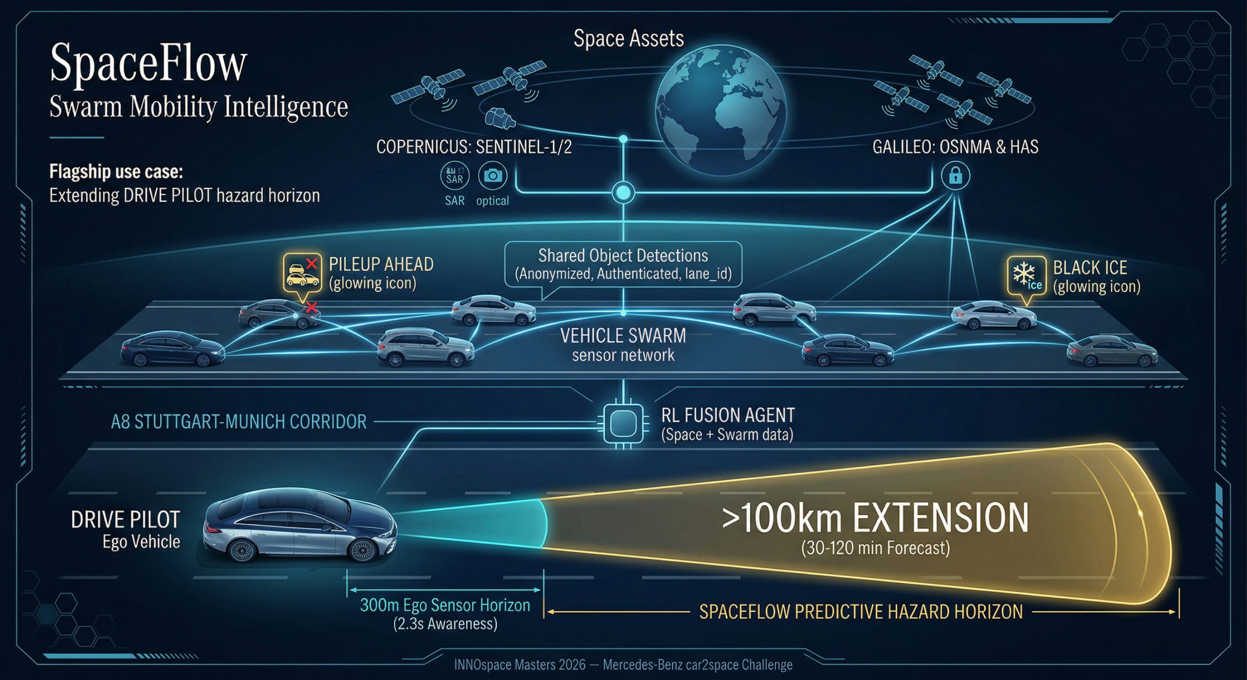
At 130 km/h, automated driving systems have only 2.3 seconds of awareness beyond their 300-metre sensor range, leaving hazards such as a pile-up 5 km ahead or black ice 20 minutes away undetected. SpaceFlow addresses this limitation by extending hazard prediction up to 100 kilometres ahead. By combining satellite radar with real-time, anonymised object-level detection data from vehicle fleets, the system generates hazard forecasts up to 120 minutes in advance. The accuracy of these predictions is significantly enhanced by the aggregated data from the fleet, enabling reliable insights beyond the sensing range of individual vehicles.
Benefits:
For the driver, the hazard detection window increases from 2.3 seconds to 30–120 minutes. This equates to a 300-fold increase in detection range.
It is suitable for all weather conditions: it combines SAR, GNSS and swarm hazard mapping (object detection by the fleet) to provide significantly improved hazard warnings, even in fog, rain and darkness, when cameras and LiDAR are ineffective.
Sim2Real Twins for Future Mobility – Digital Twins for Autonomous Mobility and Robotics Training
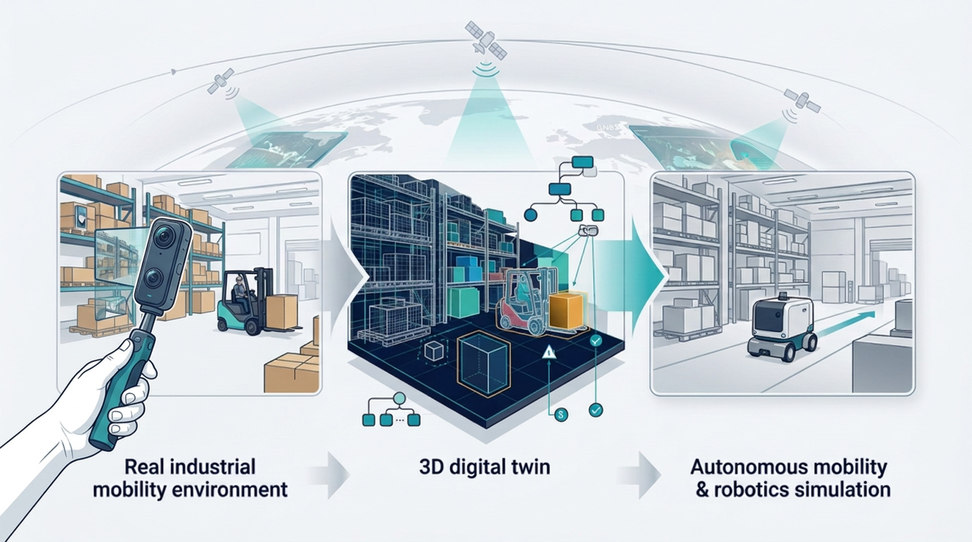
Splatica converts short video clips from the real world into structured, simulation-ready digital twins for autonomous mobility and robotics. Instead of relying on expensive three-dimensional laser scanning (LiDAR) or manually created synthetic environments, Splatica reconstructs real-world spaces using footage from standard cameras and converts these into object-aware, physics-ready OpenUSD scenes that can be used for training, validation and preparation for deployment. The vision is to make the integration of real-world environments into future mobility systems significantly faster and more cost-effective
Benefits:
Lower scene creation costs
Faster adaptation to new facilities or operating environments
Reduced manual engineering effort
More realistic testing conditions for autonomous systems
For robotics and mobility teams, this means shorter deployment cycles, faster Sim2Real transfer and better confidence before real-world rollout.
For operators of warehouses, factories, logistics hubs and similar environments, it reduces the friction involved in introducing automation and makes it easier to update environments as layouts or assets change.
New Standard for Quality in Batteries – AI-Driven X-Ray Inspection Platform for High-Throughput EV Battery Quality Assurance and Life-Cycle Diagnostics
Around 5% of battery packs are sold with physical faults created in the assembly process which can lead to catastrophic failure or high warranty costs. INNER provides a patented platform combining high-speed X-ray imaging with AI-driven pattern recognition at production speed to ensure every battery pack is fault free, safer, lasts longer, and is optimised for repair and second life.
Benefits:
The platform enables informed, low-cost repairs by quickly identifying the specific faulty cell within a 500 kg pack at production speed, providing measurable efficiency gains.
For system integrators, it allows them to offer their customers a higher level of diagnosis and reliability on the production line.
For OEMs, the benefit is a drastic reduction in warranty claims and recall costs, which currently amount to billions of pounds.
For end users, it guarantees safer vehicles and a higher resale value thanks to verified battery integrity reports.
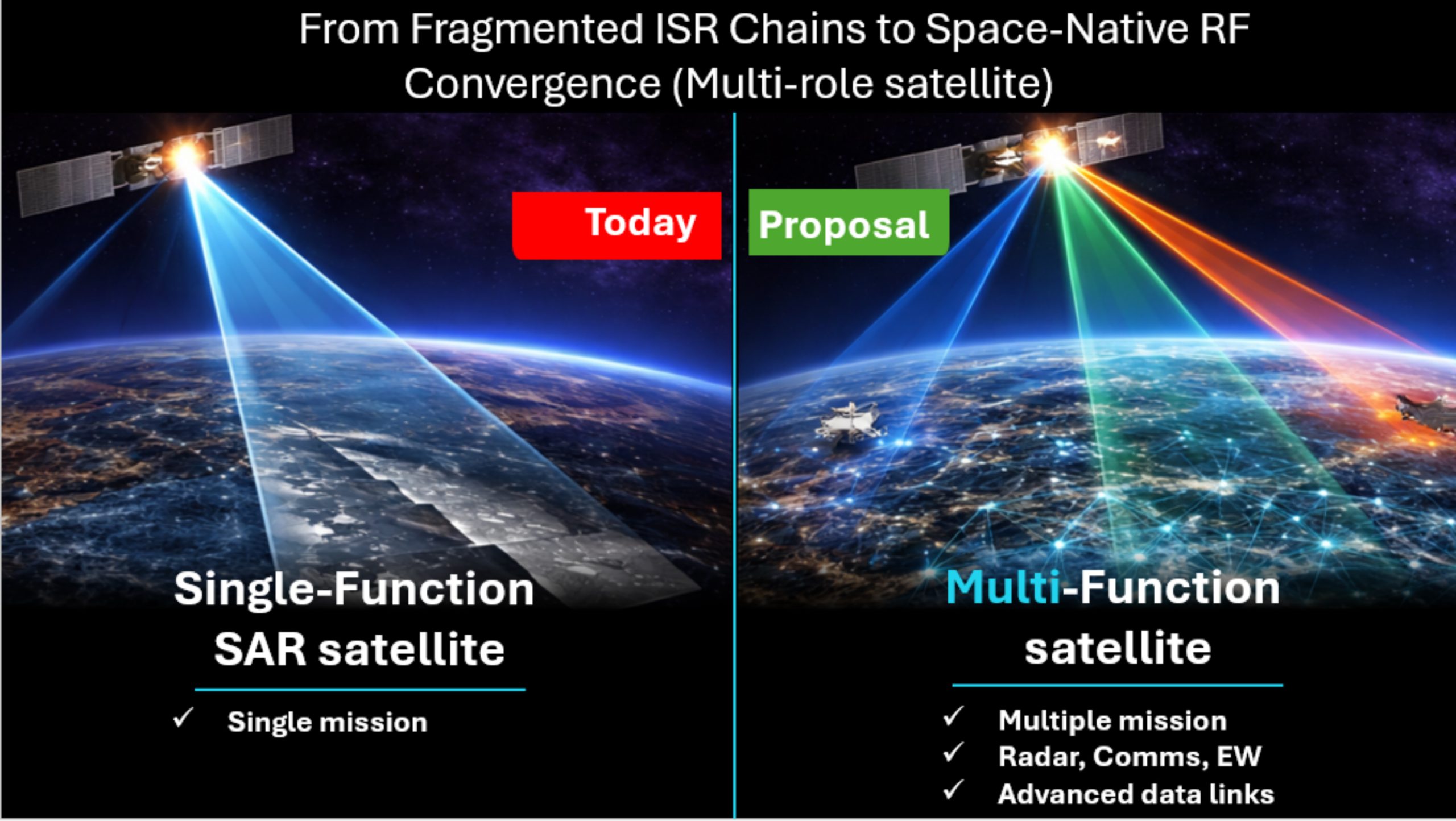
Multi-Function RF Payload – Software-Defined Multi-Function RF Payload Enabling Integrated Sensing, Communication and Signal Intelligence for Sovereign End-to-End Space Systems
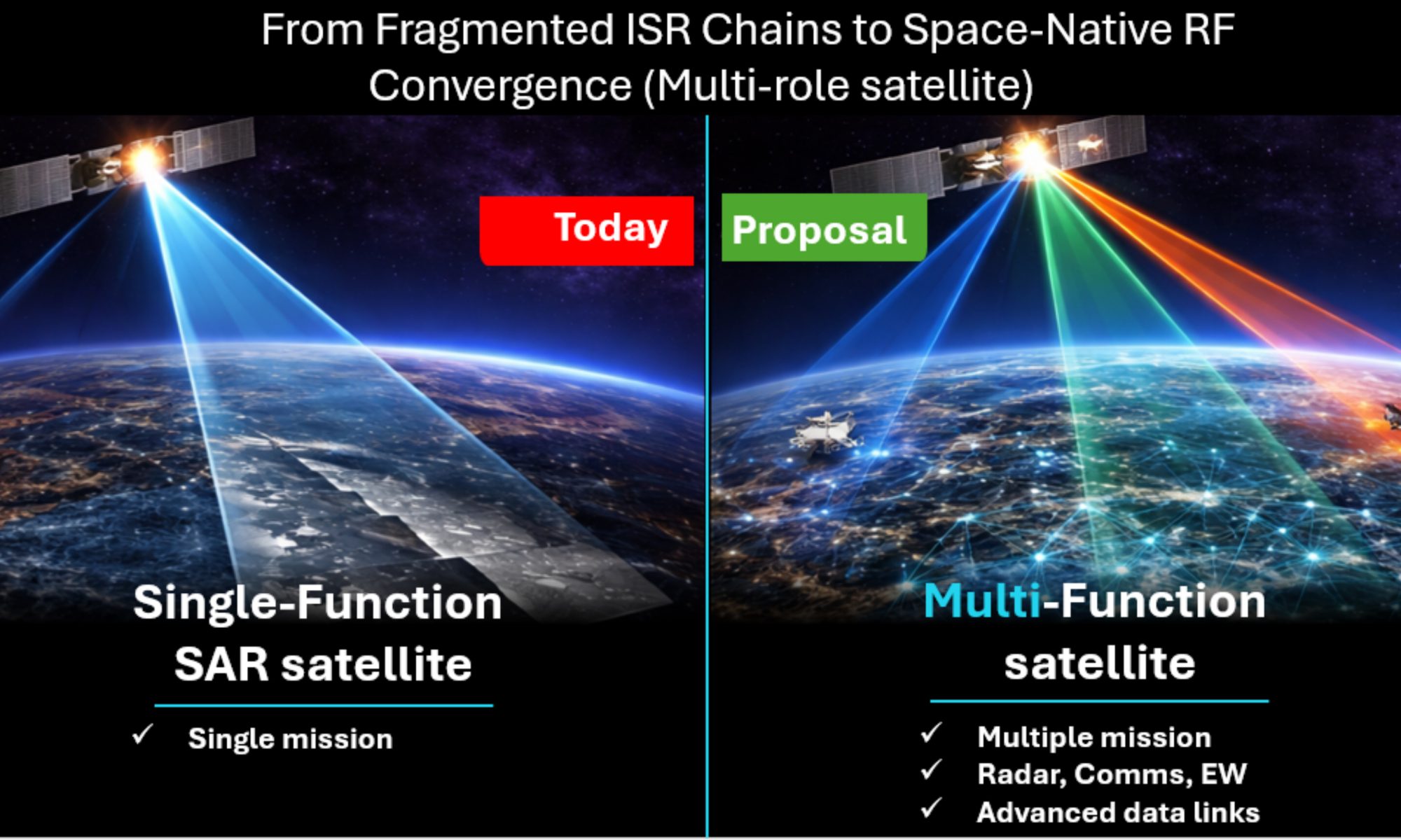
Current space architectures rely on multiple single-function payloads, limiting performance under spectrum congestion and stringent size, weight, power, and cost constraints. MaxiHertz proposes a software-defined, multi-function Radio Frequency (RF) payload enabling the integration of radar, communications, and protection functions through a shared RF aperture, enhanced with adaptive waveform and machine learning.
Benefits:
A software-defined, multi-function RF payload that enables sensing, SAR, communications and spectrum intelligence from a single payload.
Alignment with institutional and government direction across NATO members.
It contributes to modern end-to-end sovereign systems by enabling multi-function capability within a single payload.
The payload is designed for small satellites and UAVs with minimal adaptation.
It delivers improved spectrum efficiency and reduced payload mass, enhancing mission flexibility and enabling multi-domain operation.
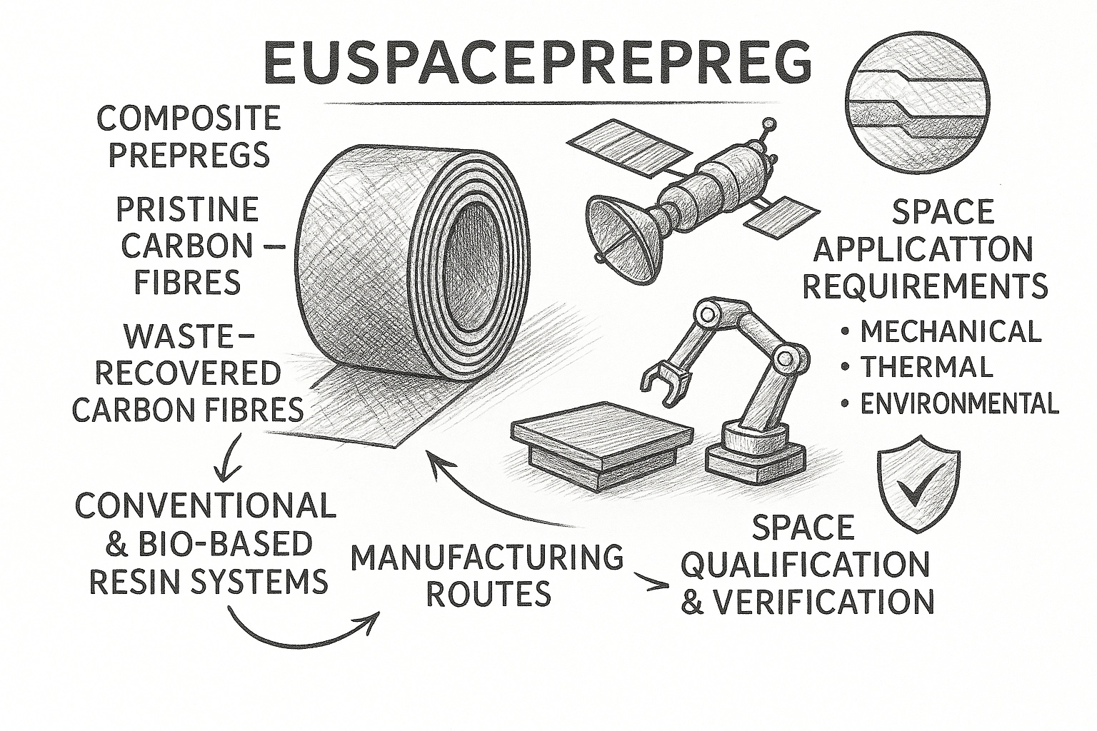
EUSpacePrepreg – Development of EU Sourced Composite Prepregs for Space Applications
EUSpacePrepreg focuses on the development and qualification of EU‑sourced composite prepregs that combine pristine and waste‑recovered carbon fibres with conventional and bio‑based resin systems, reducing reliance on petroleum‑derived feedstocks while preserving space‑grade performance. A solution that strengthens European technological sovereignty in space materials, and accelerate the secure availability of sustainable composite prepregs for current and next‑generation European space systems.
Benefits:
A new generation of EU-sourced, space-qualified composite prepregs designed for direct industrial use in space structures.
The formulation, processing and qualification of composite prepregs that combine pristine and waste-recovered carbon fibres with conventional and bio-based resin systems
Ensuring rapid integration into current value chains.
Integration of circular and bio-based material streams without compromising space-grade performance.
Reduction of exposure to raw-material scarcity, price volatility and fossil-based dependencies – while maintaining the reliability, repeatability and traceability required by space programs.
A material innovation and a deployable industrial solution that strengthens EU supply-chain resilience, supports sustainable space manufacturing and enables sovereign, end-to-end EU space systems.
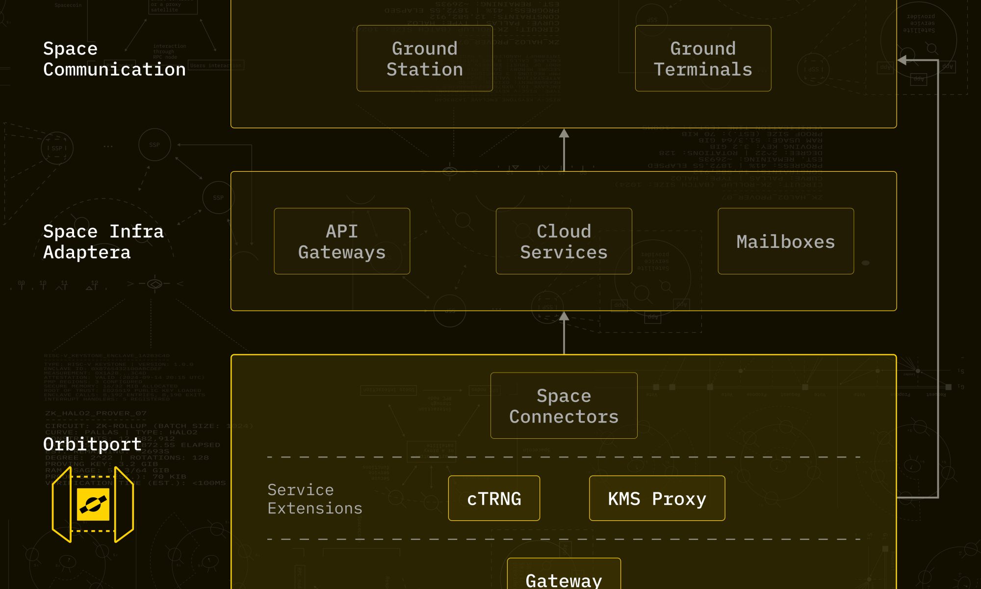
Space Fabric & Orbitport: Orbital Trust – On-Orbit Confidential Computing with Dual-Vendor Trust Anchors and PQC-Secured Ground-to-Space Communication Gateway
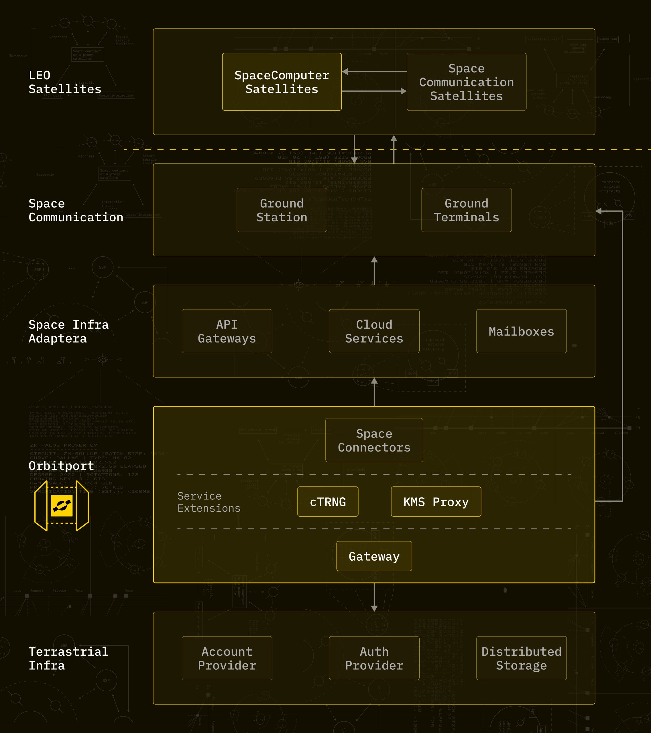
Space Fabric & Orbitport offers a sovereign end-to-end architecture that combines on-orbit confidential computing with a secure ground-to-space communication gateway, delivering a complete trust chain for next-generation space systems.
Benefits:
This is a sovereign, end-to-end architecture that combines on-orbit confidential computing with a secure, ground-to-space communication gateway. It delivers a complete trust chain for next-generation space systems.
This architecture solves two long-standing problems in space infrastructure:
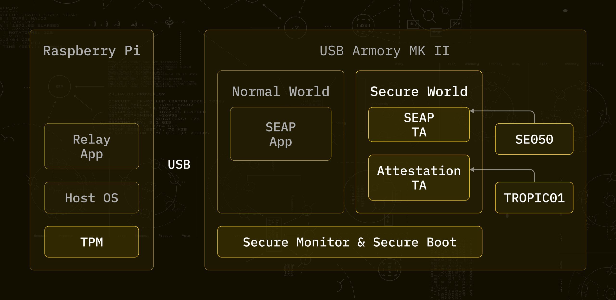
Firstly, Space Fabric uses TEEs alongside the physical isolation of post-launch space hardware computing to create a tamper barrier. It uses our unique Proof of Execution Triangulation protocol to bind execution to the satellite.
Secondly, Orbitport is a communication gateway that provides a unified, programmable interface by abstracting multiple ground station providers. This interface uses both post-quantum and classical cryptography to ensure the security of messages passing through ground stations.
It provides a sovereign flow that is secure from upload through orbital processing to result delivery and serves commercial customers who require verifiable, zero-trust space infrastructure.
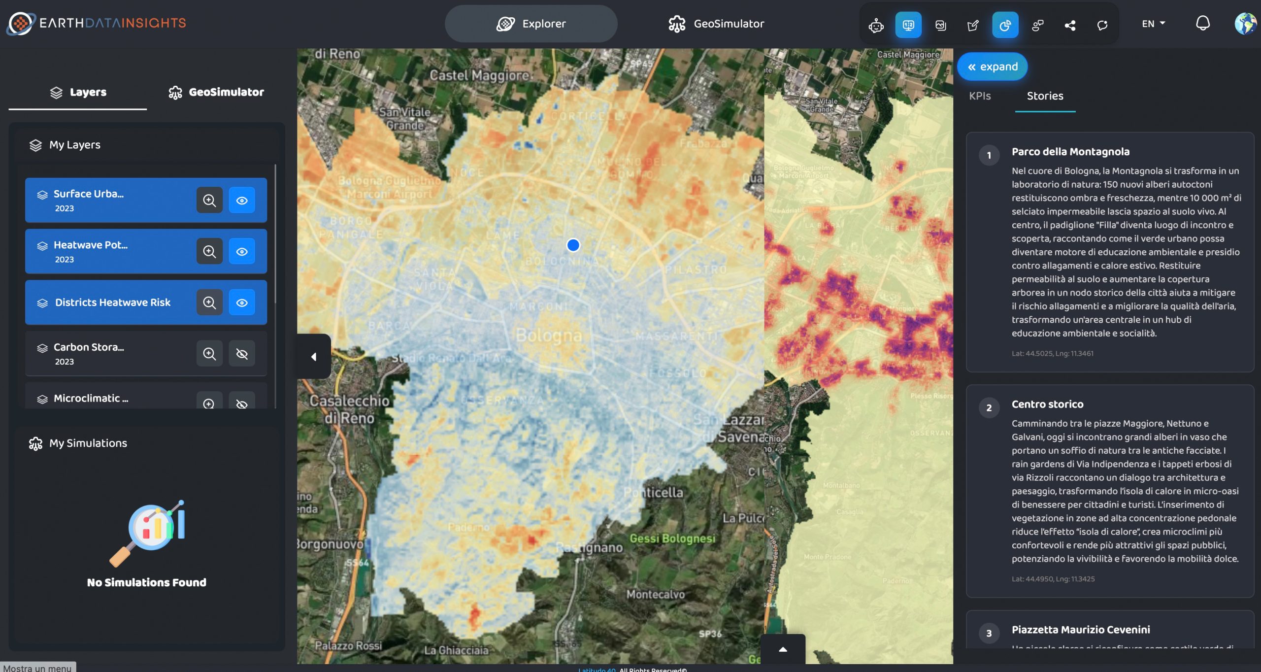
EarthDataInsights – From Orbit to Adaptation Decision: an Urban Physics Engine Turning Satellite Data into Prescriptive Urban Climate Resilience Intelligence
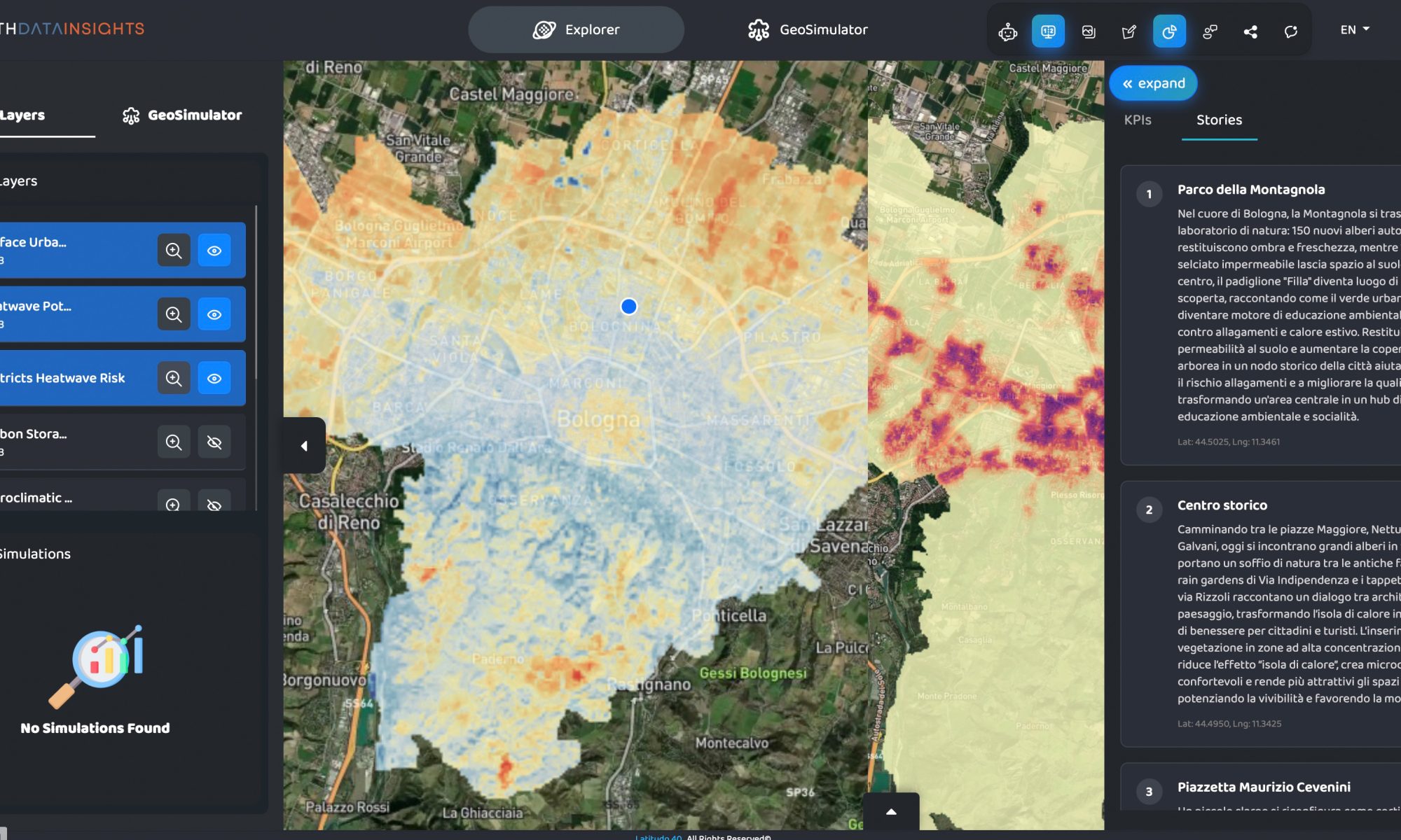
Urban heat kills more Europeans than floods and wildfires combined. Yet urban decision-makers still allocate adaptation budgets based on coarse risk scores and static hazard maps. EarthDataInsights introduces two novel capabilities: a causally-coupled Compound Urban Risk Index (CURI) that physically models interactions between thermal stress, flooding, and air quality, and an AI simulation layer that autonomously synthesises and physically validates optimal mitigation portfolios under budget, land, and equity constraints.
Benefits:
A hyperlocal geospatial software as a service (SaaS) delivering climate and environmental intelligence across Europe and the Middle East.
It is a funded, revenue-generating platform with validated pipelines for thermal stress, land use change, air quality, and flood risk, running on a processing stack.
CURI physically models causal interactions between thermal stress, surface hydrology, and air quality.
CURI operates globally using open Copernicus and ERA5 inputs, deployable in data-scarce emerging economies and growing megacities without local proprietary infrastructure.
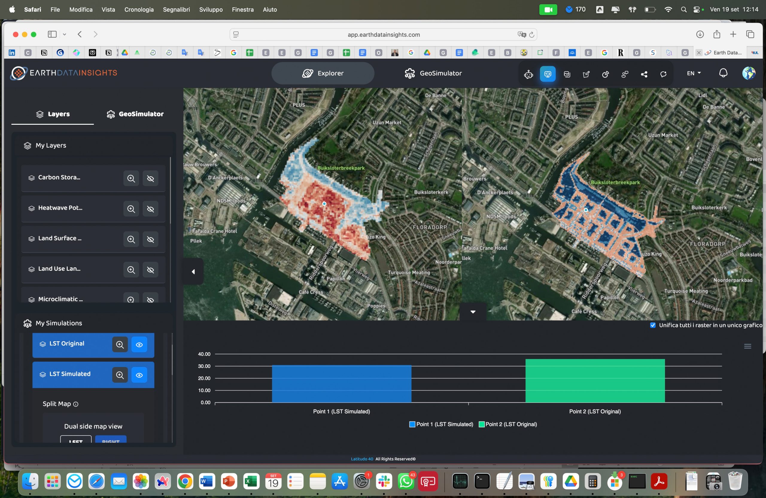
An AI mitigation synthesis layer built on Latitudo Urban Simulator: given a CURI risk map, budget, land, and equity constraints, the system autonomously generates and physically validates ranked intervention portfolios before any capital is committed.
Decision-makers receive a quantified answer: cost per unit of risk reduced and equity impact across population segments.
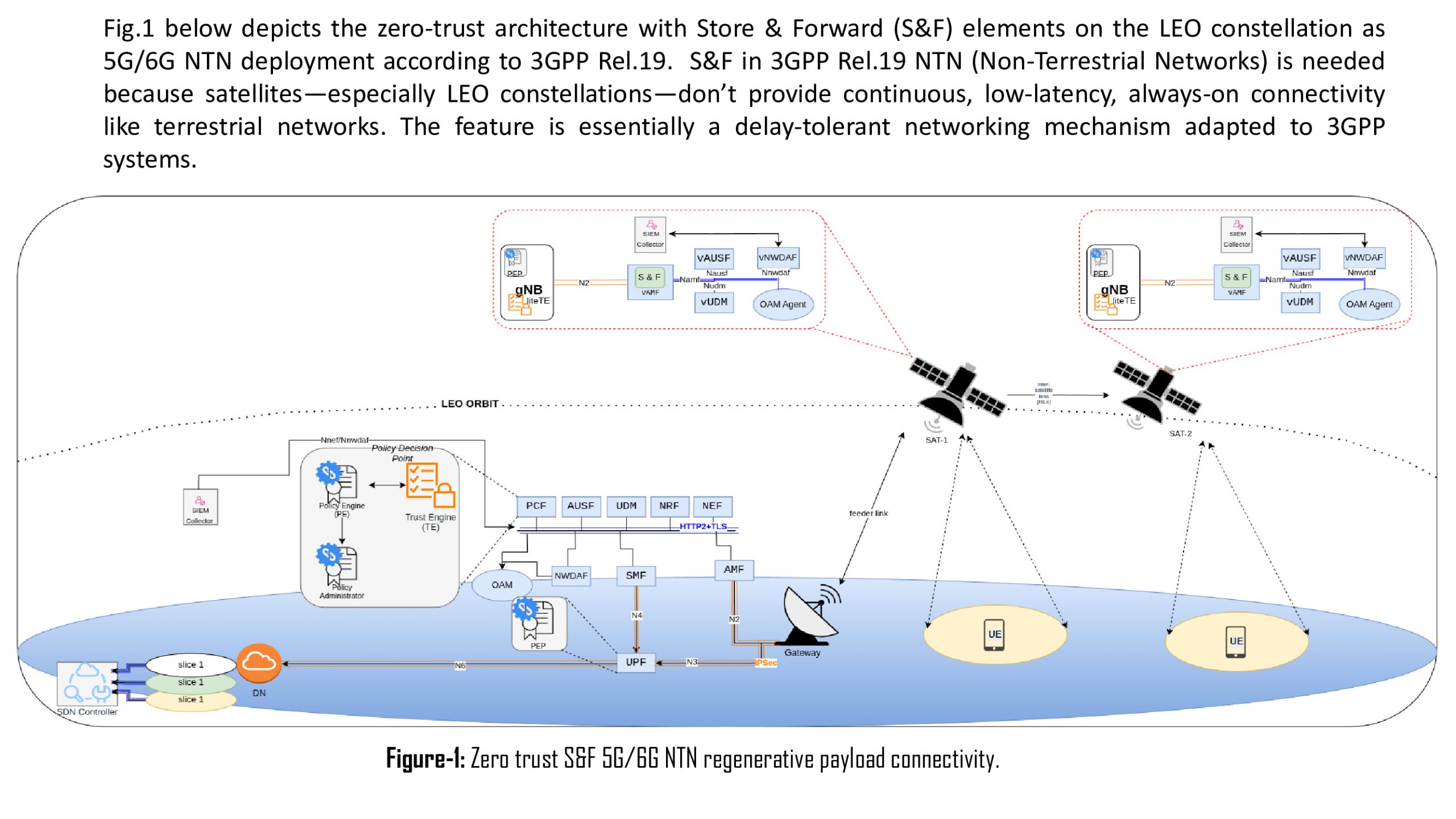
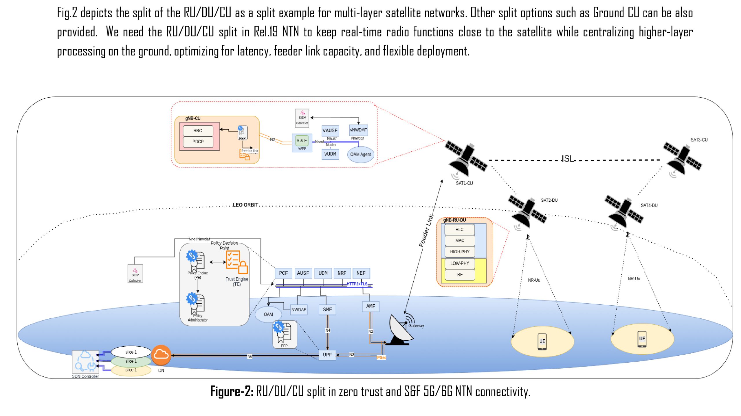
DELTA6G – A Delay-Tolerant, Secure, Multi-Orbit 5G/6G Connectivity System
As 5G/6G networks expand beyond terrestrial infrastructure, integrating satellites into global connectivity becomes essential. Current 5G/6G Non-Terrestrial Networks (NTN) integration assumes continuous connectivity, but real multi-orbit environments suffer from intermittent links, mobility, and cross-domain trust issues. DELTA6G proposes a delay-tolerant 5G/6G NTN connectivity platform that enables reliable and secure multi-orbit communication by combining store-and-forward mechanisms, distributed RAN split architectures, and zero-trust security enforcement.
Benefits:
It is a delay-tolerant, secure, multi-orbit 5G/6G connectivity platform that enables the reliable and secure integration of terrestrial and non-terrestrial networks.
It extends the UCUDU platform, based on srsRAN, towards 3GPP Rel.18/19 NTN capabilities, incorporating store-and-forward (S&F) mechanisms, distributed RAN split architectures, and zero-trust security.
The store-and-forward functionality ensures service continuity under intermittent connectivity by buffering and forwarding control and user plane data across disrupted links, enabling delay-tolerant operation in LEO/GEO environments.
Flexible RAN splitting (CU/DU) allows deployment across space, air and ground segments.
The main advantages are resilience to disruption, interoperability across heterogeneous networks and practical implementation through an existing platform.
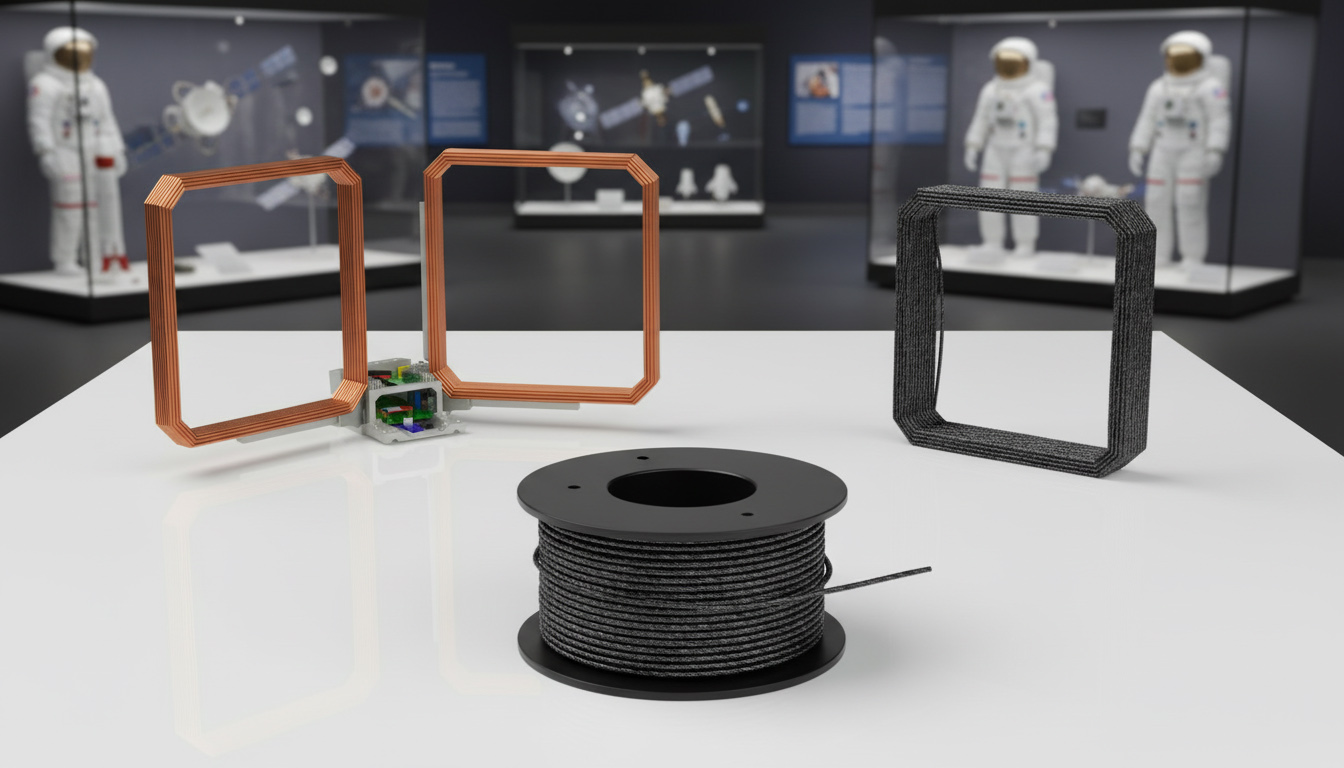
Generic Magnetic Propulsion (GMP) – A Propellant Free, Fully Electric Lorentz Force System for VLEO/LEO Small Satellite Mobility
GMP is a fully electric, propellant free propulsion system for small satellites. It generates thrust by driving controlled currents through air core coils that interact with the geomagnetic field, producing Lorentz force impulses without fuel, valves or plume contamination. This enables lighter, simpler and more sustainable spacecraft.
Benefits:
GMP replaces fuel-based propulsion with an electronics-centric system.
It simplifies integration, reduces costs, and supports sustainable operations.
It enables long-duration VLEO/LEO missions, responsive-space deployment, and plume-free manoeuvring for sensitive payloads.
The GMP system is inherently scalable: two coils support planar manoeuvres, while up to six coils enable full three-axis control.
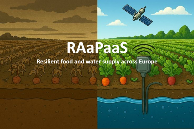
Resilient Food Water Mapping – AI Enhanced Mapping for Sustainable Food and Drinking Water Resilience: Integrated Satellite and Ground Sensor Analytics for European Agriculture
The supply of food and drinking water in Europe is increasingly under threat from climate change, groundwater depletion and rising demand. This project offers a resilient agricultural system that uses Earth observation data and smart ground sensors to enable proactive, resource-efficient decision-making. It provides real-time resource maps and classifies every agricultural parcel according to the optimal food type, water demand and expected yield under current and forecast conditions.
Benefits:
Automated pre-processing, machine learning-based land use classification and GIS-driven optimisation generate the optimal crop mix, efficient irrigation schemes and the shortest supply routes for each region.
AI models classify land use, assess water and CO₂ balances, and produce site-specific recommendations.
An interactive dashboard provides EU policymakers, farmer organisations and logistics providers with actionable advice.
Water use in recommended zones is reduced by 15–30%. Higher yield stability is achieved through climate-adapted crop selection. Transport distances are shorter, CO₂ emissions are lower and supply security is improved.