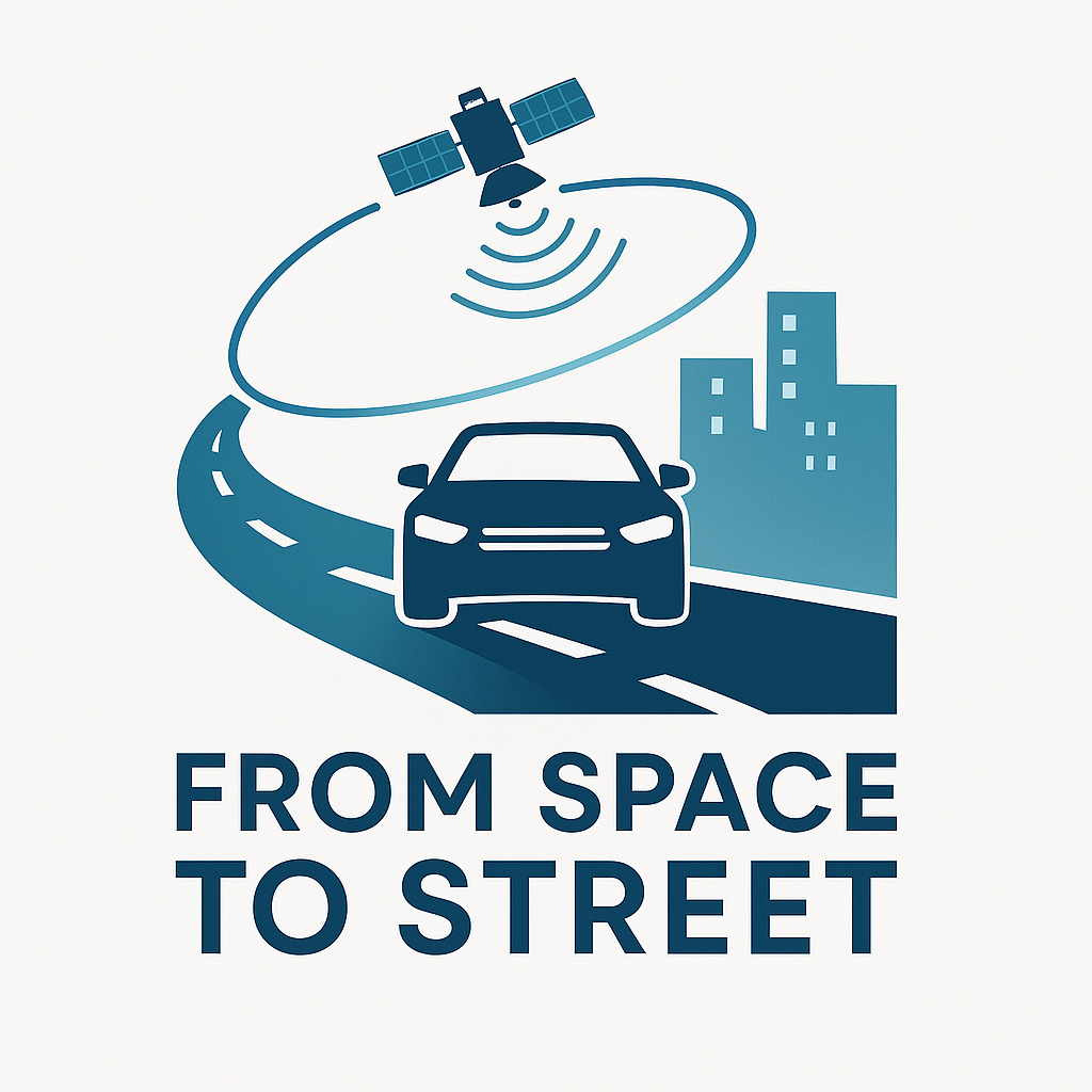
From Space to Street – Transferring SAR to transform automotive sensing with realistic radar simulation
It has been used in space for decades – now it’s time for radar to come to the road. Synthetic Aperture Radar (SAR), the technology behind some of the most precise earth observation satellites, is finally making its way into the automotive world as a key technology that makes autonomous vehicles safe and reliable.
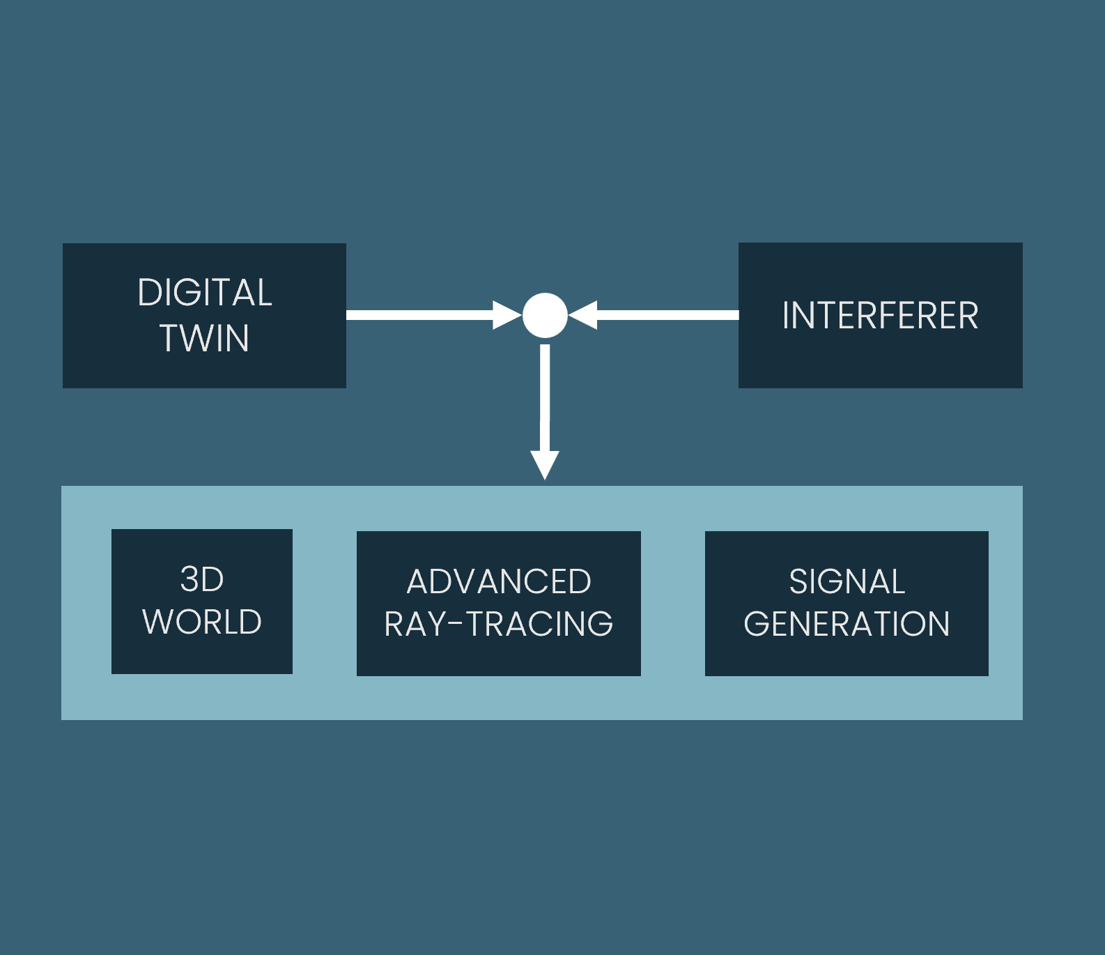
Today’s radar sensors in the automotive world still struggle with resolution and performance in complex environments. fiveD is changing this by bringing the power of SAR from space to the road. Using a purpose-built simulation platform, fiveD can virtually test how SAR-based radar can dramatically improve perception in challenging driving scenarios – such as complex urban environments or fast-moving motorways. This enables faster and more cost-effective development of next-generation radar systems without relying on expensive physical prototypes. This solution lays the foundation for smarter, more powerful radar – helping to unlock the future of safe and fully autonomous mobility.
Benefits:
By enabling physically accurate simulation early in the design process, users can explore and validate concepts before building hardware – leading to faster iteration cycles and significant cost savings.
Engineers benefit from realistic modelling of wave-level radar effects, enabling them to develop better sensors, algorithms and perception systems.
Simulation enables scalable generation of different data sets for AI training and improves performance in edge cases without costly real-world data collection.
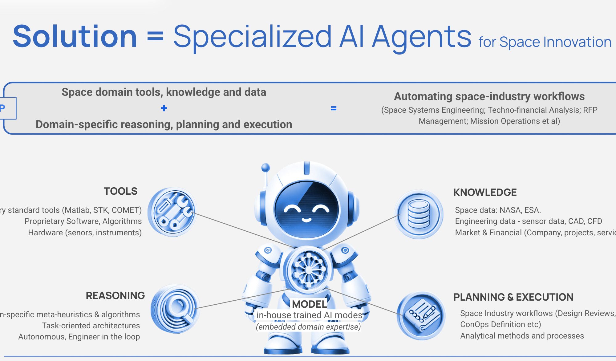
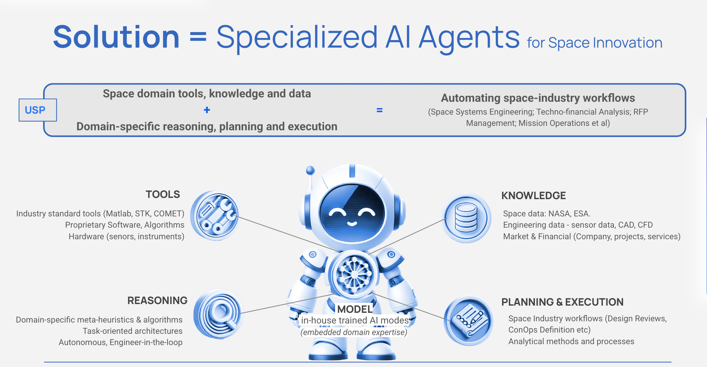
SPAIDER SPACE aims to transform space operations. With its SPAIDER AI technology, the start-up is changing the way space missions are designed, managed and executed.
The autonomous AI agents used have been specifically developed for the aerospace industry, combining state-of-the-art artificial intelligence with in-depth aerospace expertise. These specialised agents automate complex technical and business workflows that would otherwise take up valuable time from space experts. From mission planning and satellite operations to proposal development and compliance verification, SPAIDER AI takes on repetitive tasks, allowing space experts to focus on innovation. Unlike generic AI solutions, our agents understand space-specific terminology, tools, and constraints, and they integrate seamlessly with industry-standard software while preserving organisational knowledge.
SPAIDER AI represents the future of intelligent space operations, where human expertise is complemented by AI agents that work tirelessly alongside their human counterparts.
Benefits:
SPAIDER AI automates complex tasks freeing up engineers’ time to transform aerospace workflows.
For systems engineers: Agents automate requirements management, verification procedures and documentation, enabling you to focus on critical design decisions rather than paperwork.
For mission analysis experts: Agents handle repetitive trajectory calculations and analysis, accelerating planning and enabling the exploration of more design options.
For programme managers: Automated tracking, reporting and proposal development reduce project timelines and improve resource allocation.
For operations teams: Continuous monitoring agents provide a faster response to orbital events and system issues.
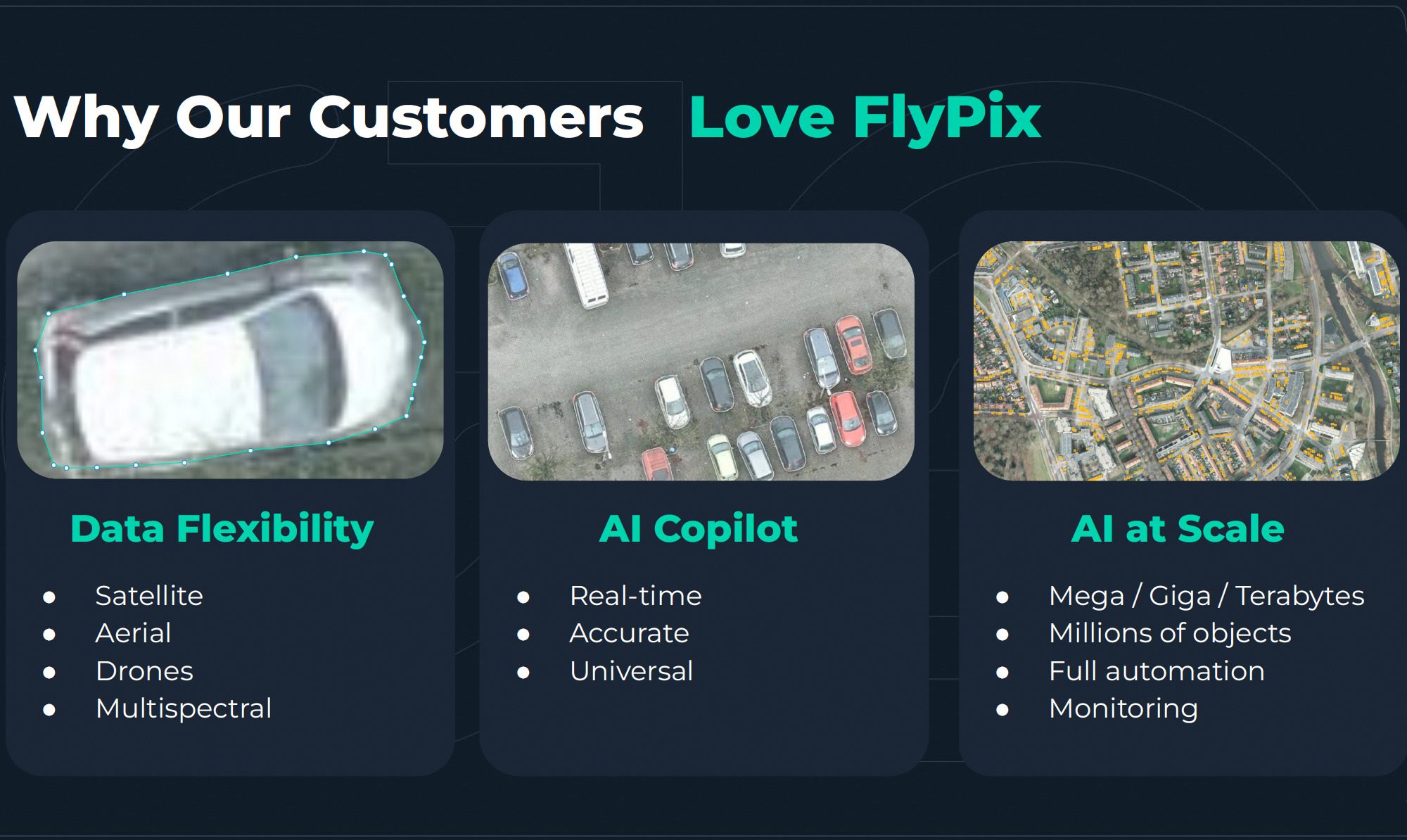
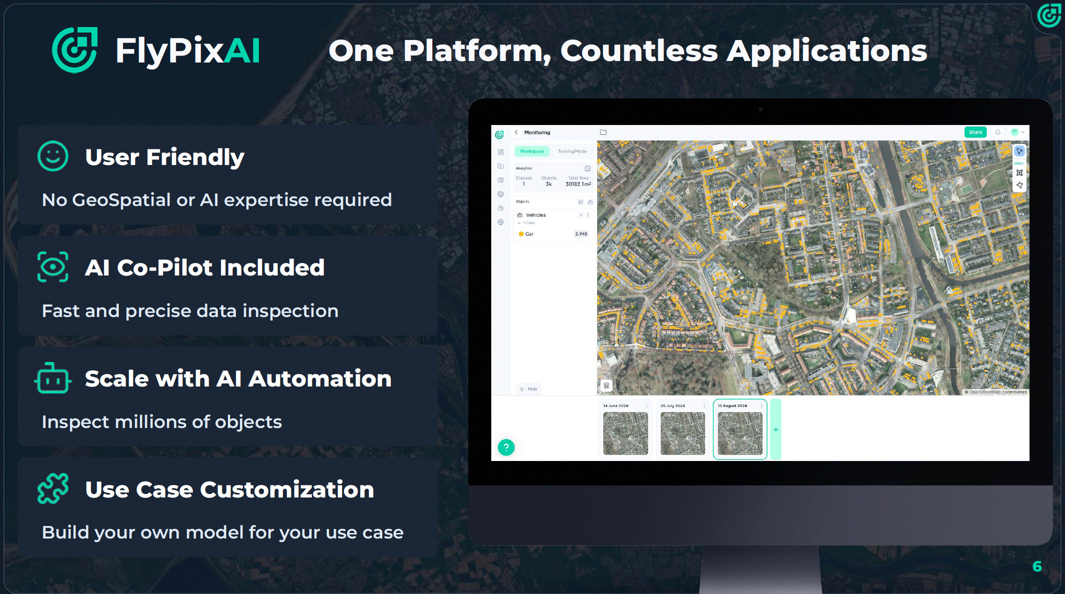
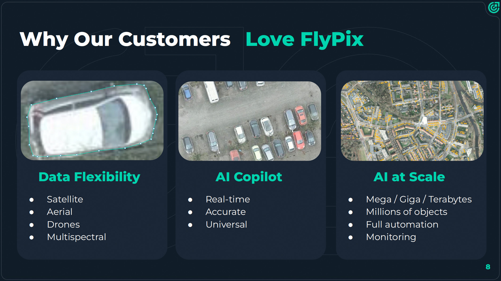
FlyPix AI – Democratising Earth observation for a sustainable future
Efforts to promote sustainability are hindered by the difficulty of translating Earth Observation (EO) data into actionable insights. Monitoring environmental issues such as illegal waste disposal, deforestation, tree health and land degradation requires specialised AI models, technical expertise and costly manual annotation. This renders EO analytics inaccessible to many municipalities, NGOs and small organisations that urgently require scalable, affordable tools to address local and global sustainability challenges.
FlyPix AI overcomes the technical and financial barriers that have prevented most organisations from accessing AI-powered sustainability monitoring. The Software as a Service (SaaS) platform integrates seamlessly into diverse workflows and transforms complex satellite and drone data into clear, actionable insights — without any technical expertise required. Whether monitoring cities, forests or infrastructure, FlyPix AI provides businesses, municipalities and organisations of all sizes with access to advanced geospatial analytics at a fraction of the cost, empowering them to make smarter decisions faster.
Benefits:
Major cost and time savings: Users can create AI models with just a few annotations, reducing costs by up to 97% and analysis time by 95%.
No-code usability: The platform enables non-experts to detect rubbish, count trees or track land changes using a simple four-step workflow.
Scalable and versatile: From small areas to citywide zones.
Better decisions: Faster automated dashboards and visual outputs improve transparency and speed up sustainability-related decision-making.
Easy integration with APIs and web dashboards: FlyPix AI can be integrated into existing systems and workflows with minimal setup.
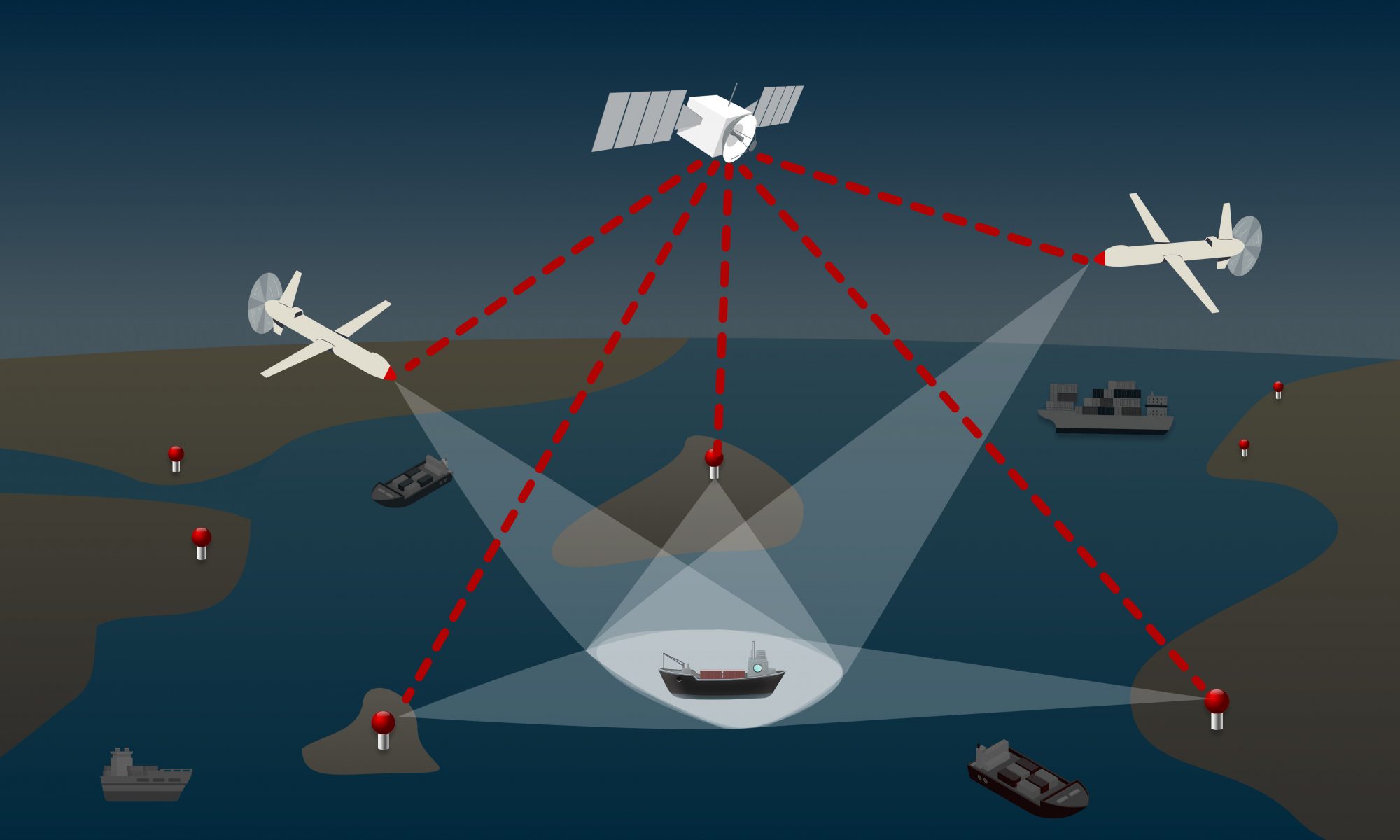
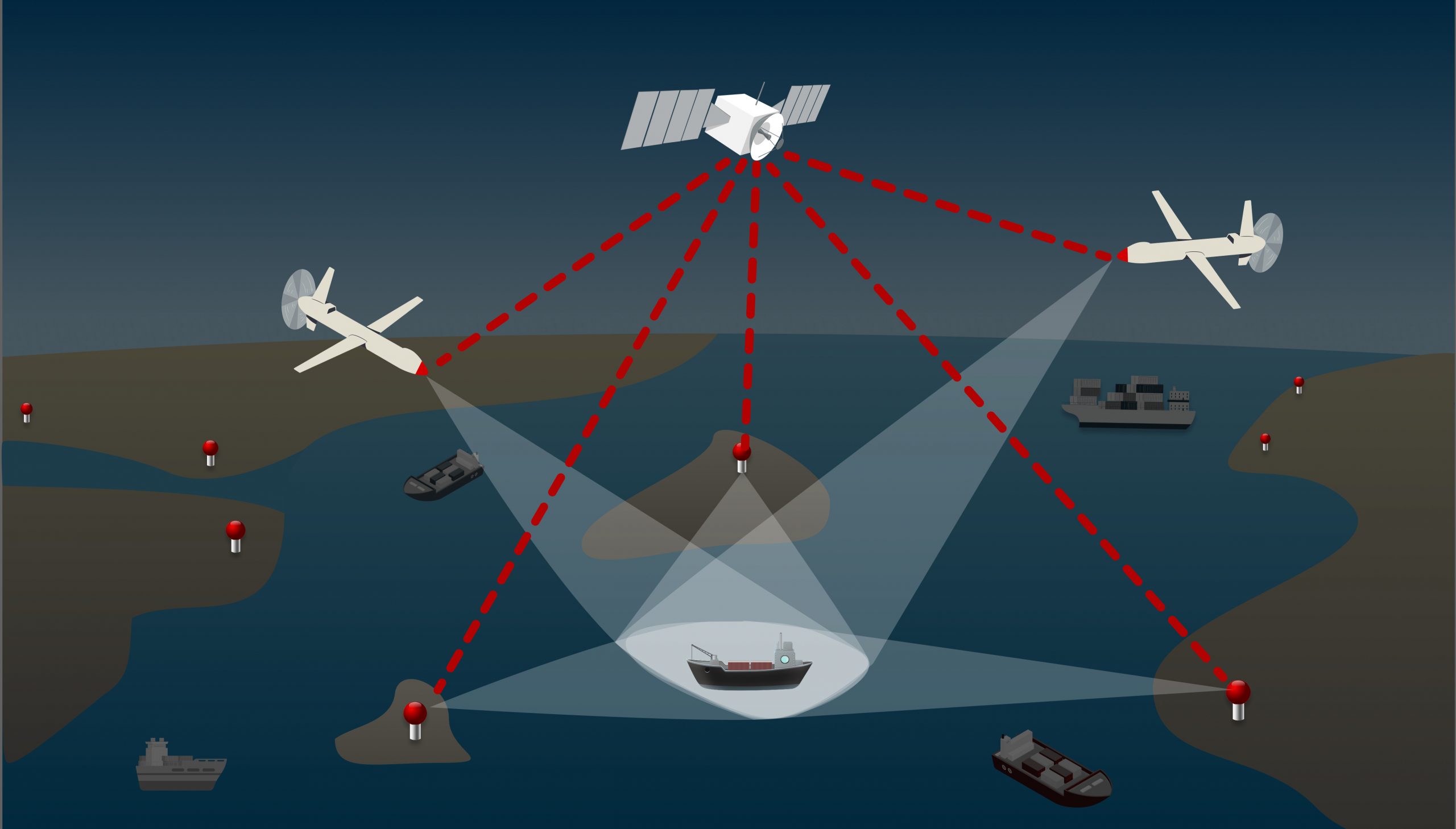
BlueSentinel – Space-enhanced monitoring system for maritime navigation and infrastructure protection
The global markets for maritime security, GNSS integrity, and the detection of uncooperative ‘dark ships’ are developing rapidly. This is due to geopolitical tensions, the expansion of offshore infrastructure, and the growing demand for robust monitoring capabilities.
BlueSentinel is an innovative, space-enabled maritime surveillance system designed to detect and track vessels, even in the most remote and infrastructure-poor regions. It builds on proven land-based tracking technology by integrating satellite timing and communication.
The system passively detects radar signals, AIS/VDES transmissions, and GNSS anomalies, and can also identify spoofing, jamming, and dark vessel activity. Its compact sensors can be deployed on drones, autonomous buoys or coastal installations, operating independently of local networks. This makes BlueSentinel ideal for enhancing maritime safety, protecting critical offshore infrastructure, and supporting environmental enforcement in inland waters, the Arctic, and beyond.
Benefits:
Real-time anomaly detection with the ability to alert, escalate or trigger satellite-based follow-up actions.
Operational resilience for maritime sector through GNSS-independent tracking (infrastructure-based sensors) and low timing requirements (achievable with RTC modules).
Extending coverage to the most challenging environments (e.g. offshore zones, Arctic regions, remote coastlines).
Seamless integration with existing systems (VTS, Coastal Surveillance, Defence Platforms).
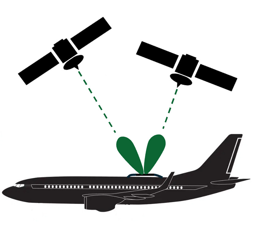
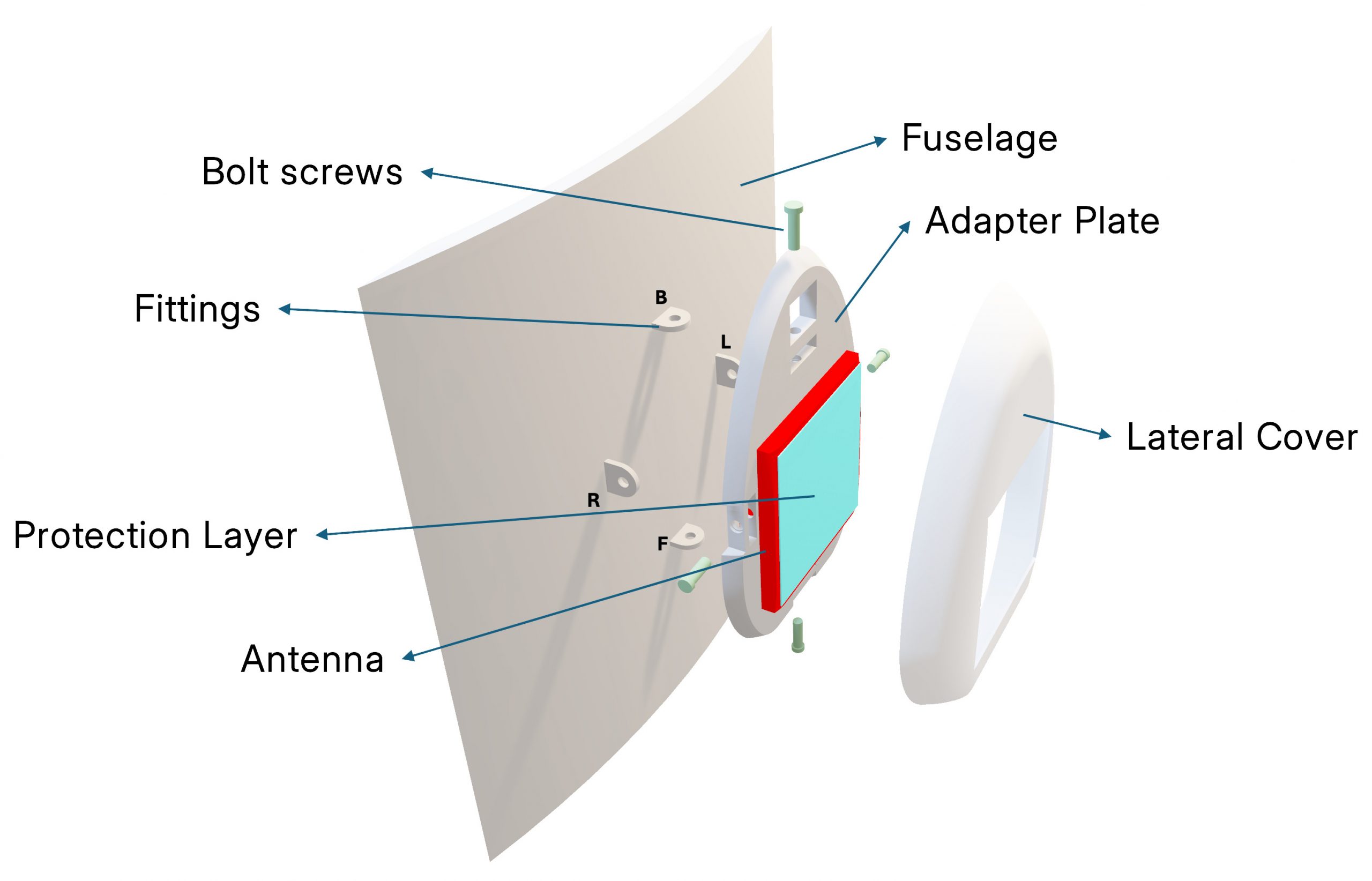
The market of In-Flight Connectivity (IFC) is growing quickly because it enables aeroplanes to provide an internet connection so that passengers can go online during the flight. The key component of an IFC satcom terminal is the antenna. It has to be installed on the top of the airplane fuselage, following clear aeronautical requirements. The design also has to be flexible because service providers have very heterogeneous needs.
The aim of this project is to design an aeronautical antenna for all IFC providers and for all types of airplanes (from airlines to business jet), for a new high-performance type of in-flight connectivity: the Augusta Space Interlaced antenna (Aspire). This antenna can be installed on any type of airplane and flexibly operate with different satellite providers to always have the best service. It is the first exclusive and smallest, real multi-beam, multi-frequency, and multi-orbit antenna on the market, and could also be used on small satellites or for other satcom terminals (e.g. automotive, IoT).
Benefits:
The ASPIRE antenna is flat, electronically steered, and has an efficiency beyond state of the art.
Modular and flexible design and offers different degrees of trade-off between complexity and performance.
Supports 2 parallel beams (thus providing higher throughputs than existing antennas on the market), and can operate them in Ku-band and/or in Ka-band.
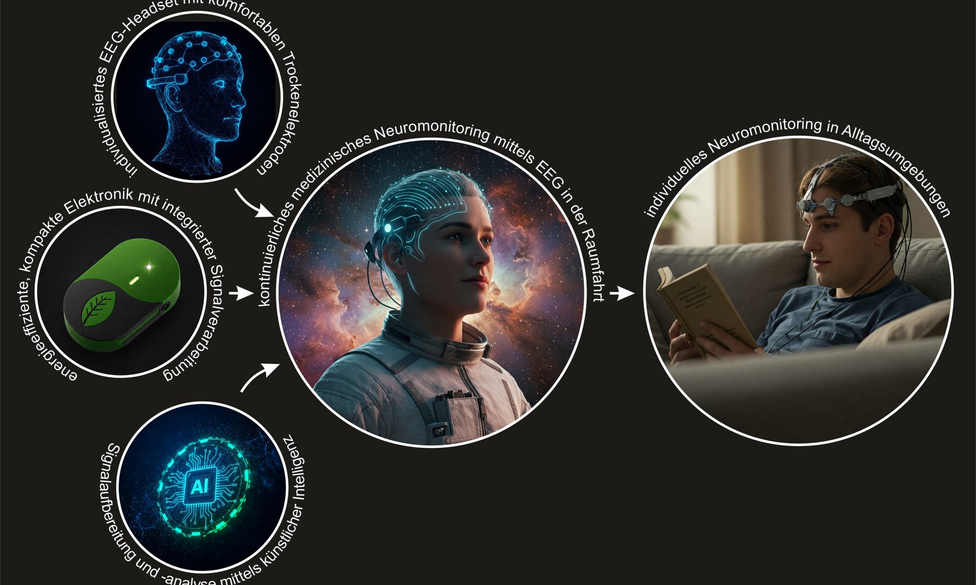
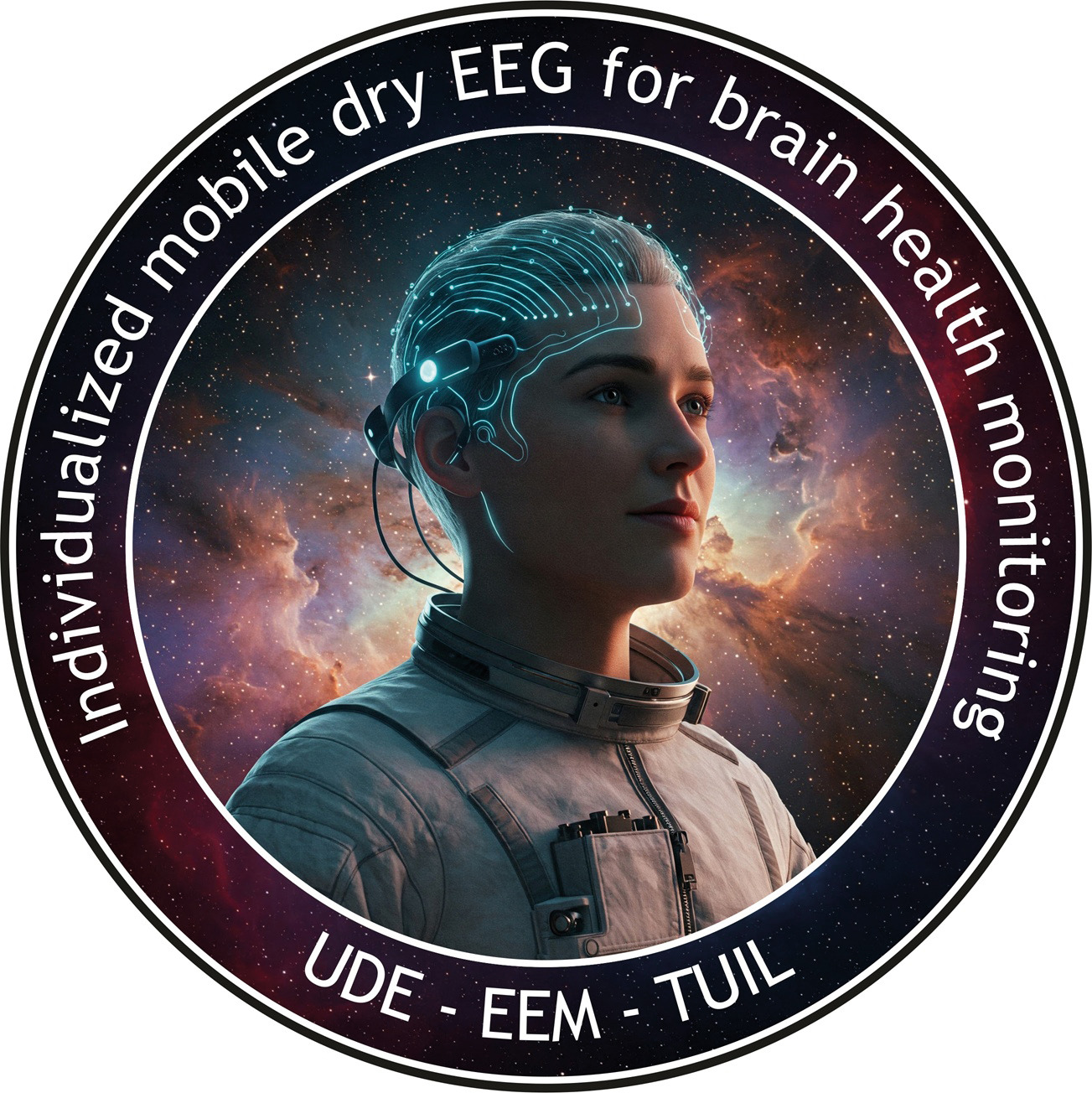
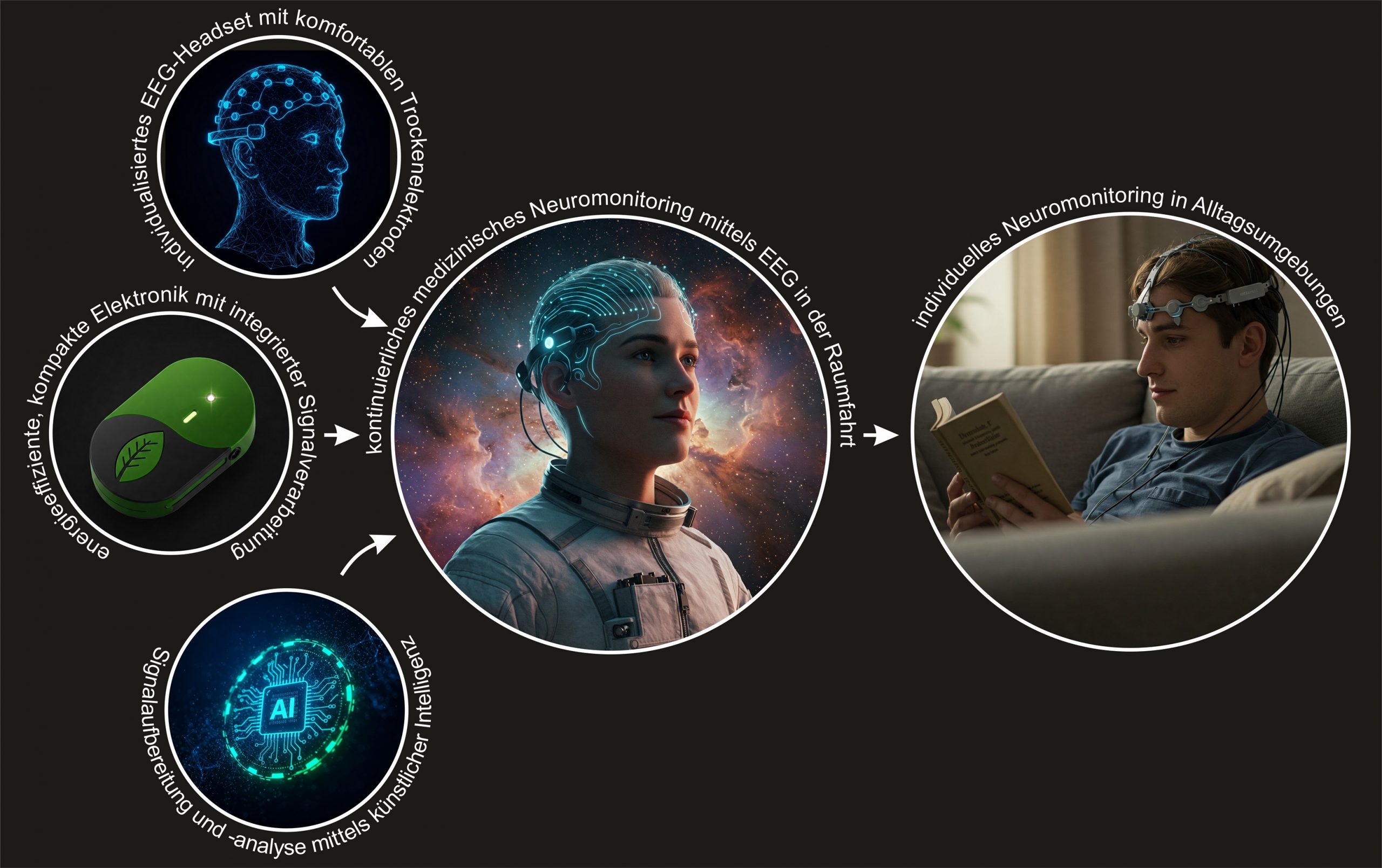
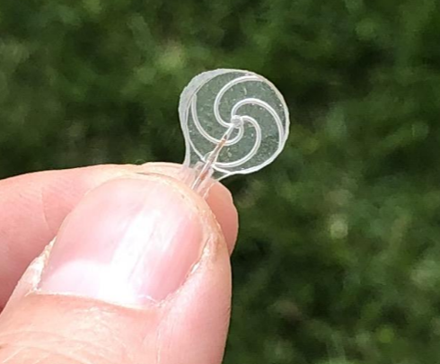
Individualised mobile dry EEG for health monitoring
Space travel negatively impacts the mental and cognitive performance of astronauts. These effects increase with mission duration and pose a risk to both the astronauts and the mission’s safety, particularly for long-term missions to the Moon or Mars.
The eemagine Medical Imaging Solution consortium is developing an easy-to-use, non-invasive dry EEG system supported by artificial intelligence (AI) for use outside the laboratory. This system is crucial for space travel as it significantly contributes to the health of astronauts by helping to avoid physical or mental overload, thereby reducing the risk of accidents and illness.
This EEG system has many potential applications here on Earth too, including in medical prevention, rehabilitation and treatment at home, and many other areas.
Benefits:
The dry EEG system will enable wider use, reduce comfort limitations and significantly improve ease of use and signal quality, while providing direct user feedback.
Combines increased sensor reliability — similar to gel-based EEG — with ease of use and high user comfort (can be applied within 10 seconds) during repeated and long-term use at a reasonable cost.
Improves the applicability of AI-supported health monitoring.
eemagine Medical Imaging Solution GmbH, Universität Duisburg-Essen, TU Ilmenau Frank Zanow frank.zanow@eemagine.com
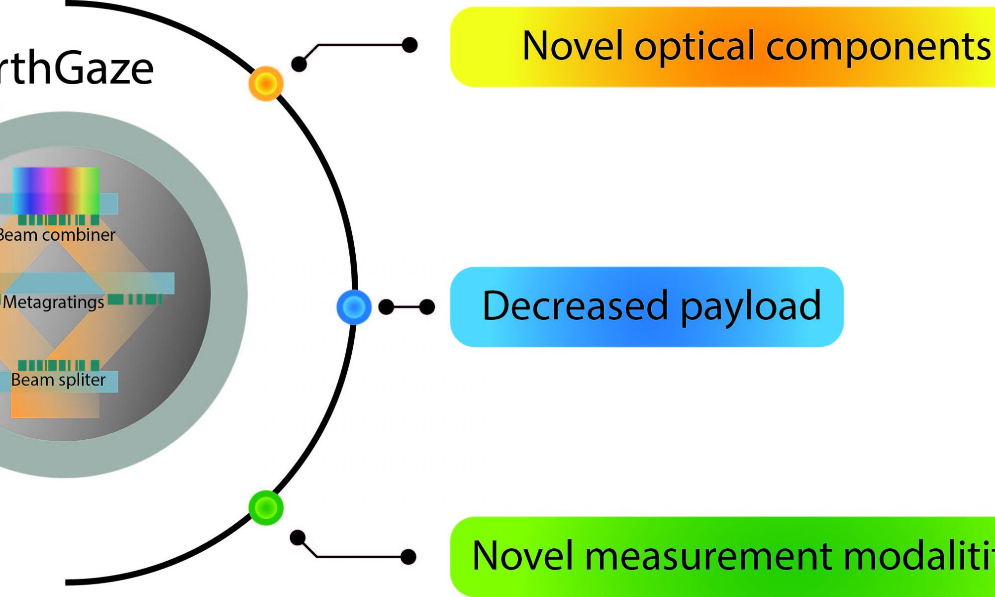
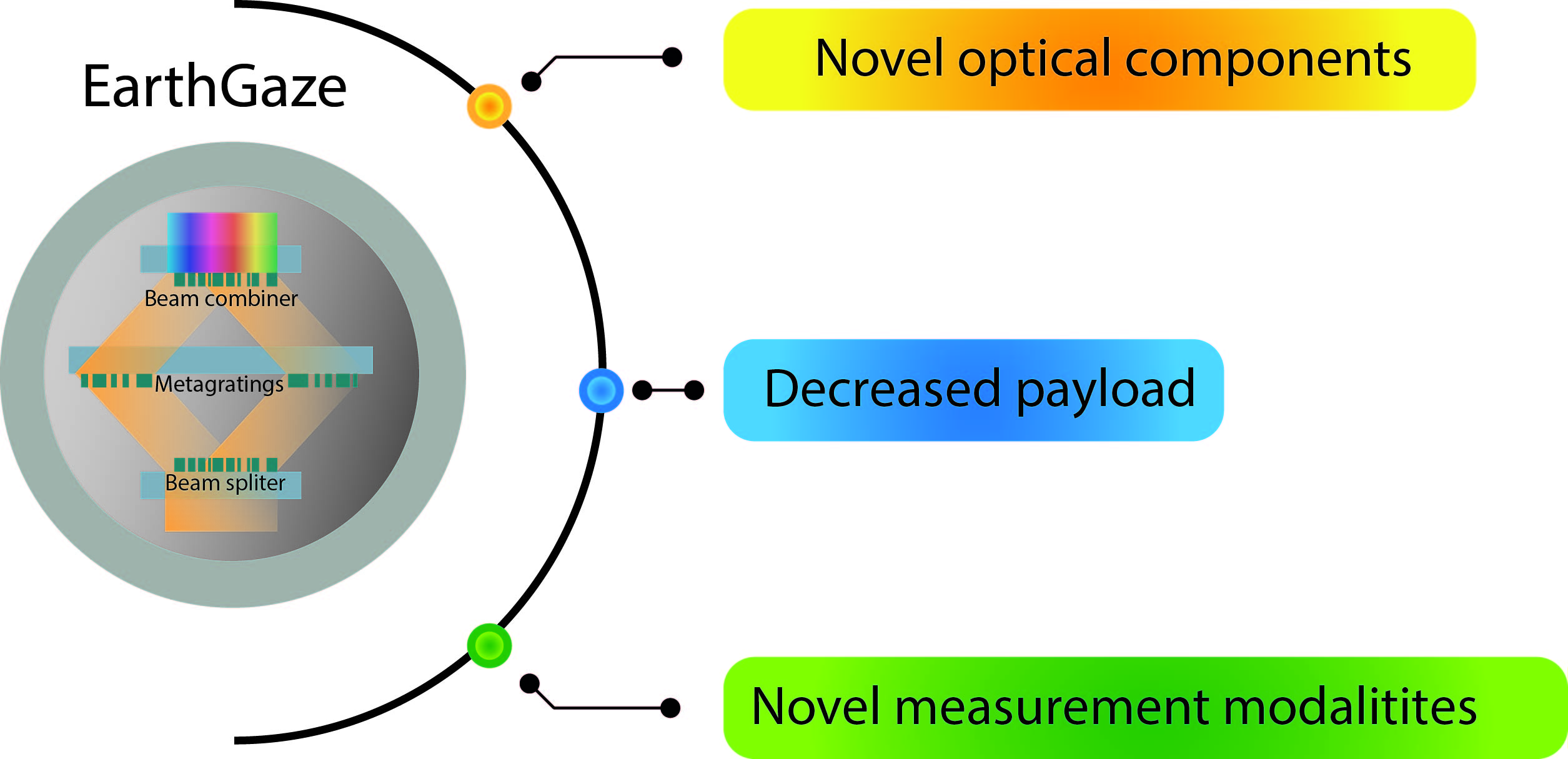
EarthGaze – Small and ultralight spectroscopic camera for space applications
A large number of spaceborne and airborne monitoring missions are conducted to measure various parameters of the Earth’s surface using off-the-shelf optical components. However, these components are often bulky and require careful alignment and intricate assembly processes, limiting their functionality.
In the EarthGaze project, the Karlsruhe Institute of Technology is developing the EarthGaze metasurface optical system: a precise, ultralight, compact, affordable and multifunctional spectroscopic imaging camera based on emerging technology of metasurfaces. This remote sensing instrument will enable comprehensive characterisation of the Earth’s atmosphere while significantly reducing the cost and effort of deploying remote sensing instruments, making it particularly attractive for airborne and spaceborne applications.
Benefits:
Weight reduction for lower launch costs and increased payload capacity of earth observation satellites.
Enhanced optical performance increases the amount of data that can be collected by a single device.
A reduction in system complexity can lead to decreased manufacturing time and reduced maintenance needs.
Streamlined manufacturing and scalability can result in substantial cost savings and make advanced optical performance more accessible for research and commercial applications.
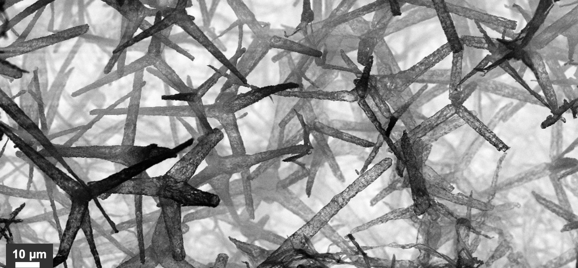
Aerostructure Multifunctional Cover Against Environmental Radiation
We all increasingly use communication networks, including Wi-Fi, mobile phones, satellite networks, Internet of Things, autonomous driving, and monitoring in medicine and the environment. People, as well as machines, will become more and more connected wirelessly. Therefore, the number of antennas integrated into electronic devices is drastically increasing, resulting in strong demand for countermeasures against unwanted signals and noise. Until now, typically metal-based materials have been used to shield electronics. While these are very secure, they are intrinsically very heavy. Moreover, the antennas themselves cannot be covered, as they would then no longer be able to transmit signals. We aim here to drastically reduce the weight of such shields by employing an ultra-lightweight class of materials, called framework aero materials. We will develop small, innovative safety caps that are easy to apply, without being a barrier to the further miniaturization of electronic devices. This new kind of cap will also enable frequency selectivity, thereby increasing the digital security of communication.
Benefits:
Ultra-lightweight cover against unwanted signals
Increase in digital security and protection against jamming
Frequency-selective: antennas can be protected
Very adaptable for specific geometries without mounting interfaces
High frequency tightness
Wide range of applications at different value-added levels
Institut für Luft- und Raumfahrttechnik der Technischen Universität Dresden Dr Tino Schmiel tino.schmiel@tu-dresden.de Institut für Materialwissenschaften der Christian-Albrechts-Universität zu Kiel Dr Fabian Schütt fas@tf.uni-kiel.de
In the manufacturing process, there is a great need for more sophisticated data analysis – a need that has been brought to us by several players from industry. While showing simple deep learning inference models run on a smartphone, we identified great potential for parameter optimisation on CNC mills, better selection of rejects of 3D-printed parts, or in turning machines. Similarly, lots of data must be processed in space, spaceship components tested on the ground before launch, and/or collected data analysed on the ground. This can be automated using AI-based data analysis of all types of sensors. We are currently in the prototyping phase for a drill chuck for a CNC milling machine, or similar, in order to train the networks and set up the generic data platform. In a second step, MAS-Tech aims to transfer the approach of CNC sensor analysis to telemetry data from ESA’s Gaia, which (to our knowledge) is processed manually, and similar space application scenarios. We will then address customers. The total available AI-based sensor market, and also the serviceable obtainable market, is tremendous and growing rapidly, especially in Germany with the many mid-sized engineering companies.
From looking for life on Mars to saving lives on Earth
Every year, 15 million babies are born prematurely and 1 million die even though 75% could have been saved if they had been given proper care. However, modern neonatal care is too complex and costly to be given to all, and simpler, safer, and cheaper medical technology must be developed to end preventable child mortality. A good example of this need is blood gas monitoring, which is an important method to monitor the health of preterm infants, but suffers from considerable complexity and safety problems that limit its usefulness. For example, it requires the skin to be heated to harmful levels and needs to be attached with strong adhesives that risk tearing the skin. We use patented gas sensor technology that we initially developed to look for signs of past or present life on Mars to perform blood gas monitoring in a completely novel way. Thanks to this sensor’s unique properties, our prototype requires neither heating nor adhesives to perform the measurements and, hence, can facilitate both safer and simpler monitoring of the infants’ health.
Benefits:
Gas sensor for planetary exploration that found use in neonatal care
Unique features enable the removal of harmful practices in conventional solutions
Shows how space technology can create simpler, safer, and more accessible neonatal care