Mars Torus

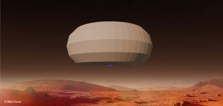
Future robotic and manned Mars missions require high-resolution images of large sections of the planet. The current geographic coverage is achieved either from great height (400 km), or by rovers directly on the surface. Mars Torus is a unique craft, able to produce high-definition images at a height of 2 km while navigating widely over the planet’s surface. Thanks to its structure and a contained vacuum, Torus achieves lift in the thin Martian atmosphere. It thus has a very low energy demand. The energy required for forward momentum and further functions can be generated by solar panels. Mars Torus will have the mobility to relocate in the atmosphere to predefined locations, helping to map locations of interest and search for traces of water and methane.
To allow Mars Torus to navigate precisely and communicate with Earth, it will have its own supporting satellite navigation system via a network of pre-positioned cubesats.
Benefits:
- High-definition images of the Mars surface
- Autonomous waypoint navigation around Mars
- Chemical sampling of the Mars atmosphere
- Reduction in the risk to future robotic and human missions

