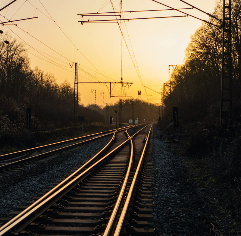
Monitoring of traffic routes by a solar-electric-powered ultralight aircraft and innovative multi-sensor 3D capturing and processing technology
Extreme weather events such as storms and drought as well as pest infestation weaken the vegetation alongside railways and roads, which can endanger operational safety. The Deutsche Bahn invests up to 125 million euros each year in the inspection and management of the tree vegetation along the railway infrastructure. Elektra Solar and RealityMaps have developed a new geodata acquisition system that significantly improves existing technologies for assessing and monitoring the health condition of the vegetation alongside railways. It consists of an environmentally friendly, solar-electric-powered ultralight aircraft, a multi-sensor 3D camera system and AI-based data evaluation. This unique system makes it possible to record aerial images, 3D elevation, thermal imagery and multispectral data simultaneously in one flight. Productivity is much higher, while providing a similar spatial resolution to UAVs.
Benefits:
Extremely efficient and environmentally friendly collection of spatial data from the air
Detailed recording of the health condition of the vegetation with a multi-sensor 3D camera system
Digitisation of up to 400 km of railways per day
Also suitable for road management and monitoring of construction measures (BIM)
Calculation of virtual 3D models and digital twins with a level of detail that has never been achieved before
With a rapidly changing climate and the emergence of readily available satellite imagery, there exists both the need and opportunity to switch over from an interval-based to a needs-based approach for the maintenance of infrastructure assets – HACARUS’s innovation helps enable this shift. Current solutions for AI-based image analysis typically require large, well-defined data sets for creating AI models. In addition, these often fail when applied to real-world scenarios due to sensitivity over discrepancies between data used for training and observed data. HACARUS’s solution is powered by its proprietary sparse modelling-based AI engine, which is uniquely adept at overcoming these challenges – the core algorithms allow for the creation of highly accurate AI models from small data sets, which means it is also able to quickly add new objects of interest. This allows for an AI system that is able to adapt to changes over time, and that can provide an instant bird’s eye view of an asset’s current health. The human-centric design, including smart features such as heat maps and bounding boxes, provides operators with actionable insights for smarter maintenance operations.
Benefits:
Enables a shift from interval-based to needs-based maintenance
Provides instant insights at a glance concerning object location & change over time
Allows for maintenance and surveillance work to be performed remotely
PhySens GmbH – magnetic rail infrastructure monitoring
Digital rail infrastructure monitoring is vital for future rail mobility. Especially for autonomous train operation, knowledge of the exact position of, e.g., a switch, is required at all times. Current systems are based on a mechanical measurement principle or operate indirectly by analysing, e.g., the current consumption of switch actuators. As a result, they provide non-continuous feedback on the real position or movements of components, which can lead to false alarms. In this case, tracks need to be closed until the components are examined, which causes delays. The new system for digital, wireless monitoring of rail infrastructure, developed by PhySens GmbH, is based on a high-precision magnetic measurement principle. The standardised, easily retrofittable sensor monitors data from switches, railroad crossings or signals, which are processed in the cloud. Using the system, the exact position of switch components or railroad crossing barriers can be determined precisely. In addition, information about the current mechanical state is provided and can be used for predictive maintenance. In this way, the system decreases delays, while simultaneously reducing maintenance costs and extending the lifetime of infrastructures.
Benefits:
Retrofittable, standardised system for infrastructure monitoring
Mechanically robust and maintenance-free sensor and cloud-based data processing
Prevention of track closures and costly maintenance work
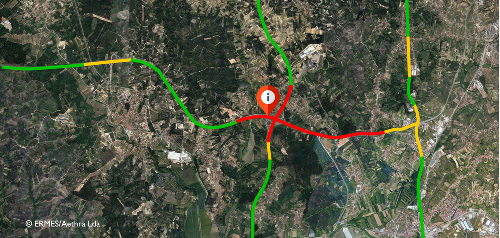
ERMES – Extensive road monitoring and early-warning system
Slope stability and ground subsidence along roads and railway tracks are currently monitored using inclinometers and land surveying. These measures lead to substantial logistical challenges and increased costs. THEIA has developed ERMES (Extensive Road Monitoring Early Warning System) to perform large-scale road infrastructure monitoring through satellite data. The system uses multiple advanced remote sensing methodologies to track ground deformation and monitor slope stability and ground subsidence throughout road and railway networks. Using high-frequency remote sensing data, ERMES can determine the speed of deformation and set up an early-warning system for structural health monitoring. This enables efficient, preventive maintenance strategies to be implemented and measures to be optimised to minimise risk.
Benefits:
Enables regular monitoring of large infrastructure using satellite data
Optimisation of maintenance costs and operations for road and rail infrastructure
Reduction of critical outages and increase in security
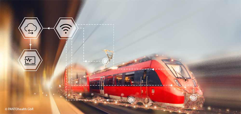
PANTOhealth – Real-time infrastructure monitoring and maintenance 4.0
A total of 3.7 million minutes, or 2,570 days, was the delay of ICE and Intercity trains in Germany for 2018 according to data from Deutsche Bahn and the German Bundestag. Infrastructure damage to railway lines is one of the main reasons for this. This is caused, in particular, by the fact that maintenance work is often carried out either too early or too late. PANTOhealth GbR aims to disrupt the maintenance plan of the mechanical infrastructures of the railway industry through condition monitoring and predictive maintenance. Its first service focuses on the maintenance of pantographs and overhead lines. Extensive data is collected via the PANTOsystem, which consists of simulation software, patented hardware for data acquisition, cameras and various sensors. Big data analysis can predict the appropriate time and exact geographic location of necessary maintenance work. This service will significantly reduce maintenance costs, while also increasing the lifetime of the pantograph and overhead line system.
Benefits:
Predictive Maintenance 4.0: Displaying of the most effective maintenance plan to reduce costs and prevent the most common causes of damage
Reduction of maintenance costs in the railway sector by up to EUR 6.6 billion annually
Considerable improvement in the punctuality of trains
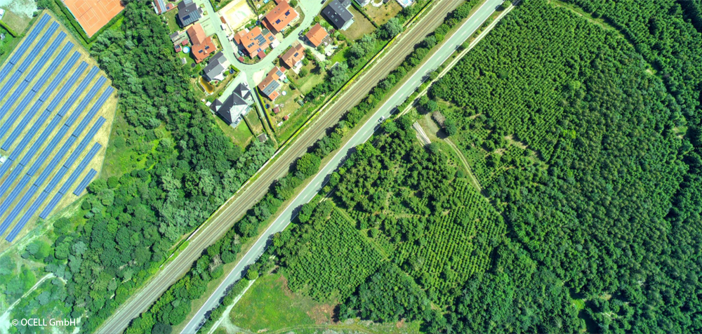
Heavy storms are increasingly causing millions of euros of damage to tracks and systems as well as train failures and delays. OCELL GmbH specialises in AI-driven analysis of aerial photography and geodata in order to collect vegetation data with an accuracy of individual trees and categorise the data according to risk classes. Data collection is carried out by the company’s own decentralised partner network of professional ultralight aircraft pilots. In order to ensure a constant ground resolution, the flight altitude relative to the ground must remain constant. This is achieved with the help of high-quality radar satellite data and navigation satellites. OCELL GmbH offers data collection and high-precision data interpretation as a comprehensive service for forestry and infrastructure managers (train lines, power lines, oil and gas pipelines). On the basis of the resulting findings, e.g. trees that pose a risk can be cut in a targeted manner as a preventative measure.
Benefits:
Prevention of delays, image damage and property damage amounting to millions of euros
Large-scale, high-resolution data collection with ultralight aircraft and the company’s own pilot network
Precise data on individual tree information (tree species, condition, height, drop distance)